Monte Agner
NORMAL ASCENT ROUTE
Approach
Suggested starting point: Rifugio SCARPA Agner
Suggested arrival point: Rifugio SCARPA Agner
Difficulty UIAA F+; I- II
Duration 4:00/5.00 h (ascent only)
Elevation gain D+ 1.150 m
Highest point 2.872 m MONTE AGNER
Lowest point 1.735 m Rifugio SCARPA Agner
Maps
Cartography: carta TABACCO 022

OVERVIEW:
Beautiful climb to the highest peak on this side of the Pale di San Martino. A very broad panorama along a challenging but extremely satisfying climb.
ITINERARY DESCRIPTION
From Rifugio SCARPA Agner follow the common signs for VIA FERRATA STELLA ALPINA and VIA DEL CANALONE. At the crossroads with signs for the via ferrata or Minussi path, turn right (minussi path). The path always crosses at a lower level than the visible tracks that go to the via ferrata or the couloir, until it abandons the path Minussi (which continues to the right). From here begin to climb the shoulder that you previously left on the left. The path climbs constantly and steeply on an unstable and rocky surface until it meets the crossroads with the road that goes up from the couloir. Up to here about 2h 45'. Then continue towards the fork up to the bivouac.
Until here 3 h.
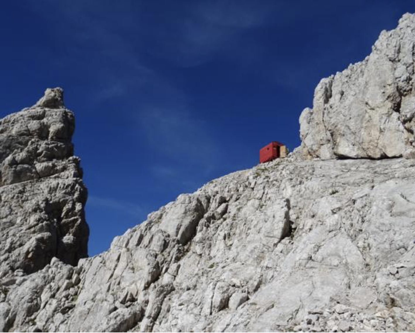
FROM BIVOUAC BIASIN TO THE SUMMIT
Climb to the top from the Biasin bivouac: right behind the bivouac, metal cables immediately begin which lead you up and across to the left. Three or four very exposed sections follow each other in rapid succession (one of which is downhill). At the end of the last stretch the ropes end inside a small channel; on the left you can see two sloping rocky ramps: the upper one is very wide and steep, the lower one is narrower and less steep. You must exit the couloir (5 m) and continue for a few meters on the lower ramp and then turn right and with a narrow zig-zag on rocks (I+) move to the upper ramp. Be careful with poor visibility not to be tempted by the lower ramp as it falls into the void between the N face of the Agner and the Armena Tower. Go up the upper and very wide ramp for approximately 20 m of altitude difference. Once out of the ramp, turn right following a red mark but you will find yourself in front of a crack about 80 cm wide and several tens of meters deep. Climb up keeping to the right of the crack on a narrow ledge (very exposed), continue for a few meters until you find a comfortable point to pass to the other side with a firm step. Still without seeing any stamps or signs, you must climb up the small wall of about 15 m against which you are leaning (climbing to the left of the crack) with passages of II. Once out of the small wall you can once again glimpse signs and cairns and a metal rope. Climb up along tracks and rocks until you come across a stretch of metal cable that allows you to reach the ridge that leads to the top. Once you have left the equipped section, you go up again along tracks (marks and clearly visible cairns) and I+ passages until you reach the summit of Mount Agner with a wooden plaque.
From bivouac to the summit: 45 min
DESCENT:
The same as the climb until the bivouac. The via ferrata downhill is not recommended, the choice is between the normal route and the couloir route (if you choose the couloir route, do not abandon the path and be misled by dubious red paint signs, but follow the entire route to the end. Pay attention to the snowfield which at a certain point on the descent might seem like a rapid descent route; in reality it has notable slopes, emerging stones, crevasses).
PLEASE NOTE:
Va posta molta attenzione nella salita alle condizioni meteo: evitare assolutamente in caso di brutto tempo e sconsigliata con visibilità scarsa. In particolarmodo l'ultimo tratto di salita alla cima pone difficoltà di orientamento e richiede passo sicuro.
Per quanto riguarda la ferrata (ma anche la via del canalone), il rischio di caduta sassi è particolarmente elevato sia per la roccia non sempre buona, sia per la verticalità del percorso.
Sassi mossi da molto in alto possono colpire anche persone in attesa di iniziare la ferrata,
Utile uno spezzone di corda per fare sicura.
La difficoltà descritta nella relazione è relativa alla salita lungo la normale, la ferrata presenta passaggi molto atletici, è in generale impegnativa, mentre il canalone tratti di III+ alternati a tratti facili o di camminata..
Pay great attention to the weather conditions: absolutely avoid in case of bad weather and with poor visibility. In particular, the last part to the top poses orientation difficulties and requires attention.
As regards the via ferrata (but also the couloir route), the risk of falling stones is particularly high due to the not always good rock and the verticality of the route.
Please be always careful in moving stones that could hit people waiting to start the via ferrata.
A piece of rope is useful for securing.
The difficulty described in the report relates to the climb along the normal route, the via ferrata has very athletic passages and is generally challenging, while the couloir features III+ sections alternating with easy or walking sections.

ROUTE MAP